Filtrer
Rechercher
Cartographie Mobile communes de Ormalingen, Bubendorf, Arboldswil Mobile Mapping Gemeinde Ormalingen, Bubendorf, Arboldswil Mobile Mapping for Ormalingen, Bubendorf, Arboldswil

Client: GISMO

Durée: 2022

Etendue: 70Km

Description: Saisie en mobile Mapping pour réseau routier des communes de Bubendorf, Ormalingen et Arboldswil

Kunde: GISMO

Dauer: 2022

Umfang: 70Km

Beschreibung: Erfassung mit Mobile Mapping für Strassennetz der Gemeinden Bubendorf, Ormalingen und Arboldswil

Client: GISMO

Duration: 2022

Scope: 70Km

Description: Acquisition with Mobile Mapping for road network for villages of Bubendorf, Ormalingen und Arboldswil

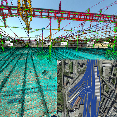
MOBILE MAPPING SUR RESEAU FERROVIAIRE DES CFF MOBILE MAPPING AUF STRECKENNETZ DER SBB MOBILE MAPING FOR SWISS FEDERAL RAILWAYS

Client: Chemin de fer fédéraux Suisses (CFF).

Durée: depuis 2016.

Etendue: Divers secteurs avec longeur totale de > 300km.

Description: Saisie de divers lignes et gares en mobile mapping sur rail (imagerie 360° et laser) sur le réseau CFF.

Kunde: Schweizerische Bundesbahnen (SBB).

Dauer: Seit 2016.

Umfang: Verschiedene Abschnitte mit einer Gesamtlänge > 300km.

Beschreibung: Aufnahme mit Mobile Mapping auf der Schiene (360°-Bilder und Laser) auf verschiedenen Streckenabschnitten und Bahnhöfen.

Client: Swiss National Railway(SBB).

Duration: since 2016.

Scope: Several segments with length > 300km.

Description: Aufnahme mit Mobile Mapping on rail (360°-images and laser) on several rail lines and train stations.

Parc Eolien "Sur Grati" Windpark "Sur Grati" Wind park "sur Grati"

Client: M+C SA

Durée: 2022

Etendue: 30Km

Description: Saisie en mobile Mapping pour analyse de transport de hélices pour un parc éolien

Kunde: M+C SA

Dauer: 2022

Umfang: 30Km

Beschreibung: Erfassung mit Mobile Mapping zwecks Analyse des Transports der Propeller für einen Windpark

Client: M+C SA

Duration: 2022

Scope: 30Km

Description: Acquisition with Mobile Mapping for analysing the transport of propellers for a wind farm

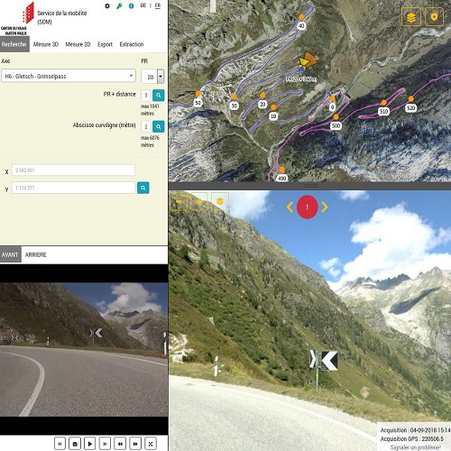
Portail Web 3D pour gestion du réseau routier valaisan 3D-Webportal zur Verwaltung des walliser Kantonsstrassennetzes 3D-Webportal for administration of cantonal road network

Client: Service de la mobilité du canton du valais (SDM).

Durée: depuis 2018.

Etendue: 1800km.

Description: Saisie de l'intégralité du réseau routier cantonal (1800km) et développement d'une plateforme web combinant images 360°, laser et vidéos.

Kunde: Kanton Wallis - Dienststelle für Mobilität (DFM).

Dauer: seit 2018.

Umfang: 1800km.

Beschreibung: Erfassen des gesamten Kantonsstrassennetztes (1800km) mit Panoramabildern, Laserdaten und Videos und Erstellen einer Webplatform.

Client: Kanton Wallis - Road Administation Agency.

Duration: since 2018.

Scope: 1800km of road.

Description: Measure of 1800km road with panoramic images, laser and videos, publishing data on customized web portal.

Savièse - Relevé des routes 2024 Savièse - Erfassung des Gemeindestrassennetzes 2024 SAVIESE - Survey of the municipal roads 2024
Images panoramiques et nuage de points des routes de la commune de Savièse Panoramabilder und Punktwolken der Strassen Images panoramiques et nuage de points des routes de la commune de Savièse
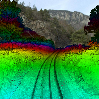
SCANNAGE MOBILE LIGNES TMR MOBILES SCANNING DES STRECKENNETZES DER TMR MOBILE SCANNINF OF TMR LINES

Client: Transports de Martigny et Régions SA (TMR).

Durée: 2019.

Etendue: Voie étroite (Martigny-Châtelard, 20km)) et voie normale (Martigny - Orsières - Châbles, 30km).

Description: Saisie des lignes et gares TMR en mobile mapping sur rail (imagerie 360° et laser) sur le réseau CFF.

Kunde: Transports de Martigny et Régions SA (TMR).

Dauer: 2019.

Umfang: Normalspur (Martigny-Châtelard, 20km)) und Meterspur (Martigny - Orsières - Châbles, 30km).

Beschreibung: Aufnahme mit Mobile Mapping auf der Schiene (360°-Bilder und Laser) auf komplettem Streckennetz der TMR.

Client: Martigny's Transports and SA region (TMR).

Duration: 2019.

Extend: Narrow rails (Martigny-Châtelard, 20km)) and normal rails (Martigny - Orsières - Châbles, 30km).

Description: Survey of rails and TMR stations in mobile mapping on rails (360° images and laser) on the CFF network.

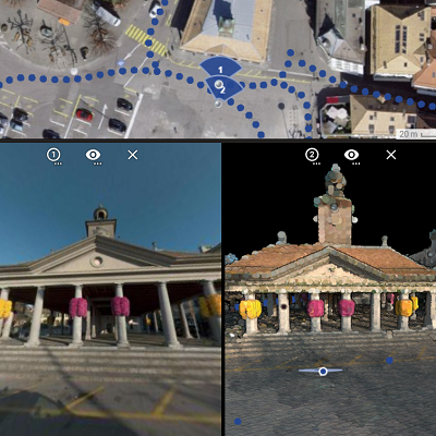
Ville de Sion (Portail Standard) Stadt Sitten (Portail Standard) Ville de Sion (Portail Standard)

Client:Ville de Sion.

Durée:2021.

Etendue:Réseau de routes communales (250km).

Description:Saisie d'images 360° et données laser haute densité et mise à disposition d'une plateforme web 3D.

Kunde:Stadt Sion.

Dauer:2021.

Umfang:Städtisches Strassennetz (250km).

Beschreibung:Erfassung von 360°-Bildern und Laserdaten und Einbindung in ein 3D-Webportal.

Client:City of Sion.

Duration:2021.

Extend:City road network (250km).

Description:Capture of 360°-images and Laserdata, Integration into 3D WebGIS.

Ville de Vevey Stadt Vevey City of Vevey

Client: Ville de Vevey.

Durée: 2020.

Etendue: Réseau des routes communal entier (45km).

Description: Acquisition en mobile mapping (laser et images 360°), mise a disposition d'un portail web pour données 3D et intégration dans SIG communal.

Kunde: Stadt Vevey.

Dauer: 2020.

Umfang: Gesamtes städtisches Strassennetz (45km).

Beschreibung: Mobile Mapping (360°-Bilder und Laser), Bereitstellung eines Webportals und Integration ins städtische GIS.

Client: Coty of Vevey.

Duration: 2020.

Extend: Entire municipal road network (45km).

Description: Mobile mapping survey (laser and 360° images), creation of a wen portal for your 3D data and integration in the municipal GIS.

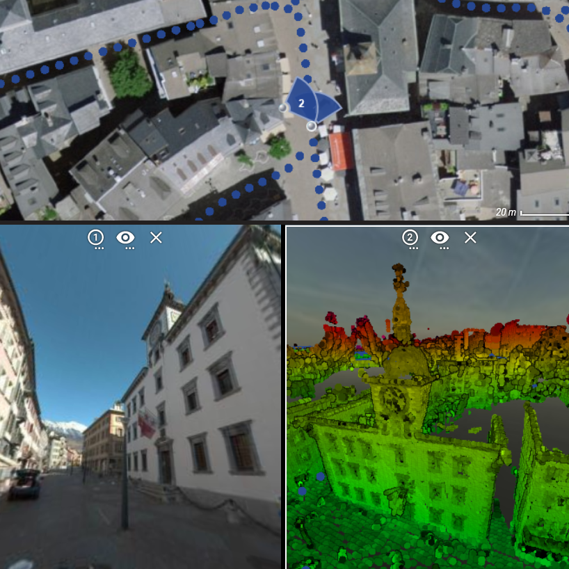
HEREMENCE - Relevé des routes communales HEREMENCE - Erfassung des Gemeindestrassennetzes HEREMENCE - Survey of the municipal roads

Client: Commune d'Hérénence.

Durée: depuis 2019.

Etendue: 150km.

Description: Saisie de l'intégralité du réseau routier communal (150km) avec images panoramiques, vidéos et nuage de points pour la zone à batir (env. 40km).

Kunde: Gemeinde Hérémence.

Dauer: seit 2019.

Umfang: 150km.

Beschreibung: Erfassen des gesamten Gemeindestrassennetzes (150km) mit 360°-Bildern und Videos, Aufnahme mit mobilem Laserscanning für Bauzonen (40km).

Client: Municipality of Heremence.

Duration: since 2019.

Extend: 150km.

Description: Capture of the entire municipal road network (150km) with panoramic images, videos and point cloud for the building zone (approx. 40km).

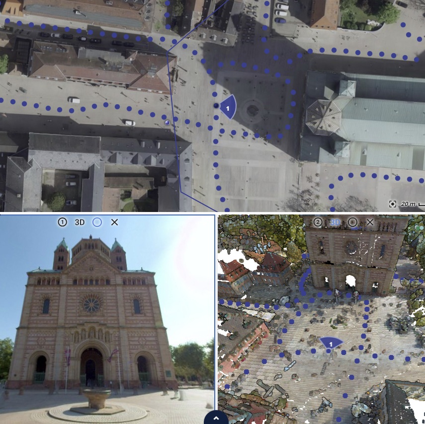
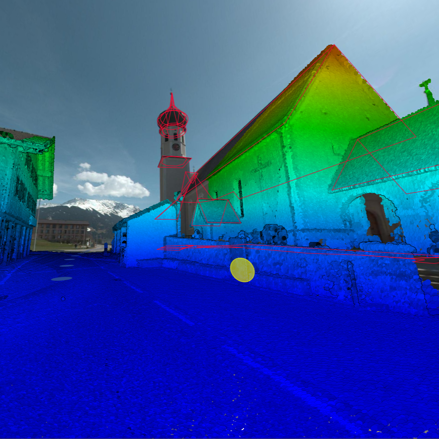
GEMEINDEN SILBERTAL UND BARTOLOMÄBERG

Client: Vermessung AVT-ZT-GmbH

Durée: 2023

Etendue: 100Km

Description: Saisie en mobile Mapping du réseau de route communal de Silbertal et Bärtolomeaberg pour contruction de maquettes 3D des batiments

Kunde: Vermessung AVT-ZT-GmbH

Dauer: Seit 2016.

Umfang: 100Km

Beschreibung: Erfassung mit Mobile Mapping der Gemeinden Silbertal und Bärtolomeaberg zwecks Rekonstruktion der Gebäudehüllen

Client: Vermessung AVT-ZT-GmbH.

Duration: 2023.

Scope: 100Km

Description: Acquisition with Mobile Mapping of communal road network of Silbertal and Bärtolomeaberg for construction of 3D building models

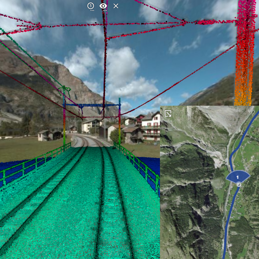
MGB BRIG-ZERMATT/BRIG-DISENTIS

Client: Matterhorn-Gotthard Bahn (MGB)

Durée: 2021

Etendue: Réseau ferroviaire complet (150km)

Description: Acquisition d'images 360° et données laser haute densité, analyse gabarits d'espace libre et mise à disposition d'une plateforme web 3D

Kunde: Matterhorn-Gotthard Bahn (MGB)

Dauer: 2021

Umfang: Gesamtes Schienennetz (150km)

Beschreibung: Erfassung von 360°-Bildern und Laserdaten, Freilichtraum-Analyse, Einbindung in ein 3D-Webportal

Client: Matterhorn-Gotthard Bahn (MGB)

Duration: 2021

Extend: Complete rail network (150km)

Description: Acquisition of 360° images and high-density laser data, analysis of free space templates and provision of a 3D web platform
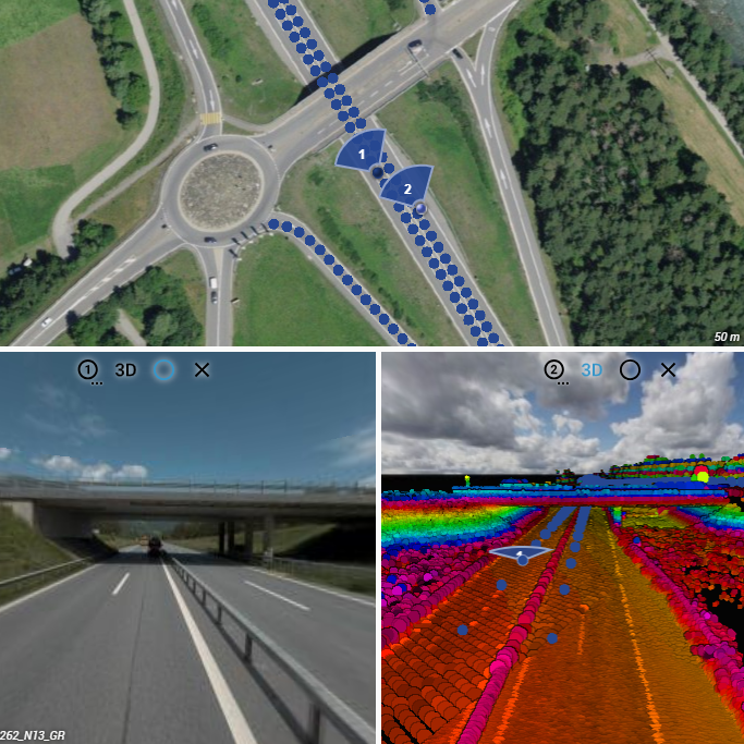
N13 Thusis-Landquart

Client: OFROU - Filiale Bellinzone

Durée: Depuis 2020

Etendue: >100Km

Description: Saisie en mobile Mapping de divers secteurs sur la route nationale N13 entre Landquart et Thusis/p>

Kunde: ASTRA- Filiale Bellinzona

Dauer: Seit 2020

Umfang: >100Km

Beschreibung: Erfassung mit Mobile Mapping verschiedener Sektoren der Autobahn N13 zwischen Landquart und Thusis

Client: ASTRA- Filiale Bellinzona

Duration: Since 2020

Scope: >100Km

Description: Acquisition with Mobile Mapping of different sectors on the highway N13 between Landquart und Thusis

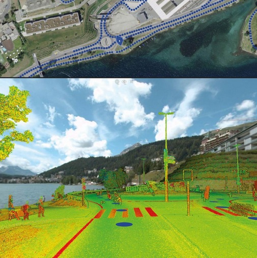
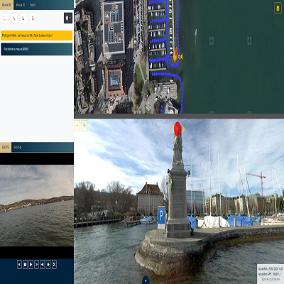
Panoramabilder/Videos Zürichsee

Client: Tiefbauamt Stadt Zürich.

Durée: 2020.

Etendue: Les rives du canton de Zurich ce trouvant sur le territoire du canton de Zurich (> 70km).

Description: mobile mapping sur l'eau (images 360° et vidéos géoréférenceés) des rives du lac de Zurich depuis l'eau et mise à disposition d'un portail web dédié.

Kunde: Tiefbauamt Stadt Zürich.

Dauer: 2020.

Umfang: Alle Uferbereiche des Zürichsees im Kanton Zürich (> 70km).

Beschreibung: Mobile Mapping vom Wasser aus (360°-Bilder und Video) der Uferbereiche und Bereitstellung mit einem Webportal.

Client: Tiefbauamt Stadt Zürich.

Duration: 2020.

Extend:Edges of Zurich's canton located on Zurich's canton territory (> 70km).

Description: Mobile mapping on water (360° images and geo-referenced videos) of riversides of Zurich's lake and creation of a dedicaded web portal.